
Ngarra Networks Selected for ON Prime 18 to Advance Disaster Response Innovation
We are proud to announce that Ngarra Networks is collaborating with the University of New England (UNE). They have been selected to join in ON Prime 18. This is CSIRO’s flagship innovation program designed to accelerate the translation of cutting-edge research into real-world impact. Our project focuses on creating an autonomous drone-based disaster management system. This system can transform how Australia responds to bushfires. It can also change responses to floods and other natural hazards.


Project Scope: Ngarra SkyHive
Our drone-based disaster management system is designed to serve a wide range of end-users across Australia. It particularly serves those involved in emergency response. It also serves those in environmental monitoring and critical infrastructure management. Key national customers include state and federal emergency services. These services are the National Emergency Management Agency (NEMA) and various State Emergency Services (SES). They also include fire and rescue authorities. Finally, they include departments of environment and planning across jurisdictions. These agencies manage bushfires, floods, and other natural hazards. They need real-time situational awareness to coordinate effective responses.
The system is especially valuable in regional and remote areas. In these locations, emergency response times are longer. Communication networks are often limited. Geographic isolation increases vulnerability. Local councils, rural fire services, and regional disaster response teams can use the technology to assess risks. They can monitor evolving threats and coordinate community-level actions in real time. They do this independently of existing infrastructure.
Infrastructure and utility operators—like energy providers, water authorities, and telecommunications companies—can deploy the system to assess asset damage. They can rank repairs and maintain service continuity during and after emergencies. This is particularly useful in hard-to-reach locations.
Humanitarian organizations, including the Red Cross and other NGOs involved in disaster relief and recovery, also represent key users. The system can generate real-time maps. It can prioritize affected zones. This enables more efficient, targeted deployment of personnel and resources. It ultimately improves outcomes across the country.
Our Solutions
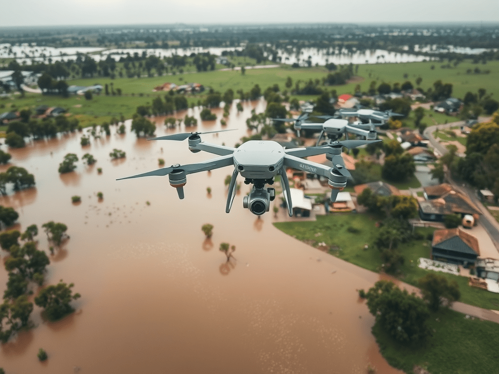
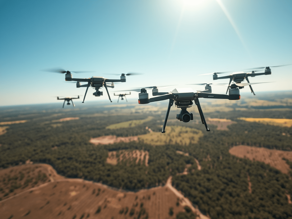
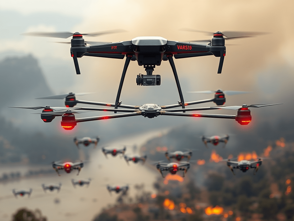
Our solution offers an innovative, drone-based disaster response system. It combines a high-capacity “mothership” drone with a swarm of intelligent, cooperative “dronoids.” This modular aerial platform is designed to rapidly deploy in disaster zones like bushfires and floods. It delivers real-time, high-resolution data across large and inaccessible areas. The core value is in its ability to coordinate aerial data collection autonomously. It does this through swarm intelligence and inter-drone communication. This significantly reduces the time, cost, and risk associated with traditional ground or manned-aircraft-based response methods.
Each dronoid is equipped with advanced sensors capable of detecting heat, smoke, gas levels, fire edges, and water flow. These units share information through a mesh network, dynamically adapting their positions and scanning tasks to maximize coverage.
The mothership drone acts as a mobile base station, aggregating and processing data in real-time using onboard AI. This enables emergency services and decision-makers to receive a comprehensive, live operational overview of the evolving disaster.
Our system enhances situational awareness, supports faster and smarter decision-making, and allows for targeted deployment of resources and personnel. Unlike conventional systems, it is autonomous, scalable, and operable even when communication infrastructure is damaged. The result is a safer and more efficient approach to disaster response. It is data-driven. This can save lives, protect critical infrastructure, and reduce environmental and economic impact.
